Aperçu
Touch the Sky in the Majestic Pamir Mountains
Experience the thrill of reaching altitudes of 4,800 meters and witness the unparalleled beauty of the Pamir Mountains with Pamir Journey. Cross high mountain passes, admire pristine snowfields, and see glaciers melting into crystal-clear streams.
Join our group tour, starting with a minimum of four participants, or opt for a private tour for a more personalized experience.
Pricing:
• 4 travelers: Starting from 1,850 USD per person
Discover the grandeur of the Pamirs and create memories that will last a lifetime.
Points forts
- Weather and Climate
- The Pamir is one of the highest and most remote mountain regions in the world, with elevations up to 7,500 meters. Therefore, we must prepare for extreme climatic conditions. In Dushanbe and Osh, as well as in the lower-lying parts of the Pamirs, daytime temperatures can reach up to 35° C. On the Pamir Plateau and in the Pik Lenin yurt camp, it can also be quite cold at night in summer, with temperatures dropping below freezing.
- Single room surcharge
- The single room surcharge applies to overnight stays in hotels in Dushanbe and Bishkek, as well as the guesthouse in Kalai-Kumb. In the guesthouses in Savnob, Karakul, and Sary Tash, we cannot guarantee single rooms. In the yurts at Pik Lenin, we are accommodated in groups of a maximum of 5 people per yurt. The yurts are not available for single use. During the camping nights, the single use of a two-person tent is included in the travel price.
- Travel itinerary and route
- The Pamir is poorly developed in terms of infrastructure, and the roads are often in a desolate state. Due to weather conditions, it may happen that we cannot pass the roads. Therefore, there may be changes in the program schedule. The program outlined above represents the optimal variant. Our travel dates are based on the usually favorable weather conditions at that time.
- Entry and Documents
- For entry into Tajikistan and Kyrgyzstan, citizens from Germany, Austria, Switzerland, and Italy need a passport that is valid for at least six months, proof of return or onward travel documents (tickets), and no visa for a stay of up to a maximum of 30 or 60 days. Citizens of other countries are advised to inquire at their respective representations.
- For a stay of more than three days in Tajikistan, registration is required. A GBAO special permit is needed for travel to the Pamirs. We will take care of both documents. They are included in the travel price.
- Please check the current travel and safety advisories as well as the entry requirements online. German citizens can find information at the Federal Foreign Office at www.auswaertiges-amt.de, Austrian citizens at the Ministry of Foreign Affairs at www.aussenministerium.at, and Swiss citizens at the Federal Department of Foreign Affairs at www.eda.admin.ch.
- Vaccinations and Health Prevention
- There are no mandatory vaccinations for entry into Tajikistan and Kyrgyzstan. However, it is important that your standard vaccinations against tetanus, diphtheria, and polio are up to date. Additionally, we recommend considering vaccinations against hepatitis A. For longer stays or certain activities, vaccinations against hepatitis B and rabies may also be advisable. It is best to discuss this with your doctor or a tropical medicine specialist. Center for Travel Medicine: www.crm.de; Robert Koch Institute: www.rki.de These sites do not replace a doctor's visit. Allow enough time and ideally contact your doctor several months before the trip to create a vaccination plan.
- Pack a personal travel pharmacy tailored to your needs. It is sensible to include medications for diarrhea, headaches, and colds, as well as bandages and plasters. We carry a general emergency pharmacy and a well-equipped first aid kit on the tour. However, these are only intended for real emergencies and should not replace personal preparation.
- If you have any chronic health issues, you should definitely consult your family doctor before the trip. Due to the altitude in the Pamirs and the associated low oxygen levels in the air, as well as a significant temperature difference between day and night (about 20 °C), your body is under much greater strain than normal. Especially for cardiovascular problems or asthma, we strongly recommend discussing these issues with your family doctor.
Itinéraire
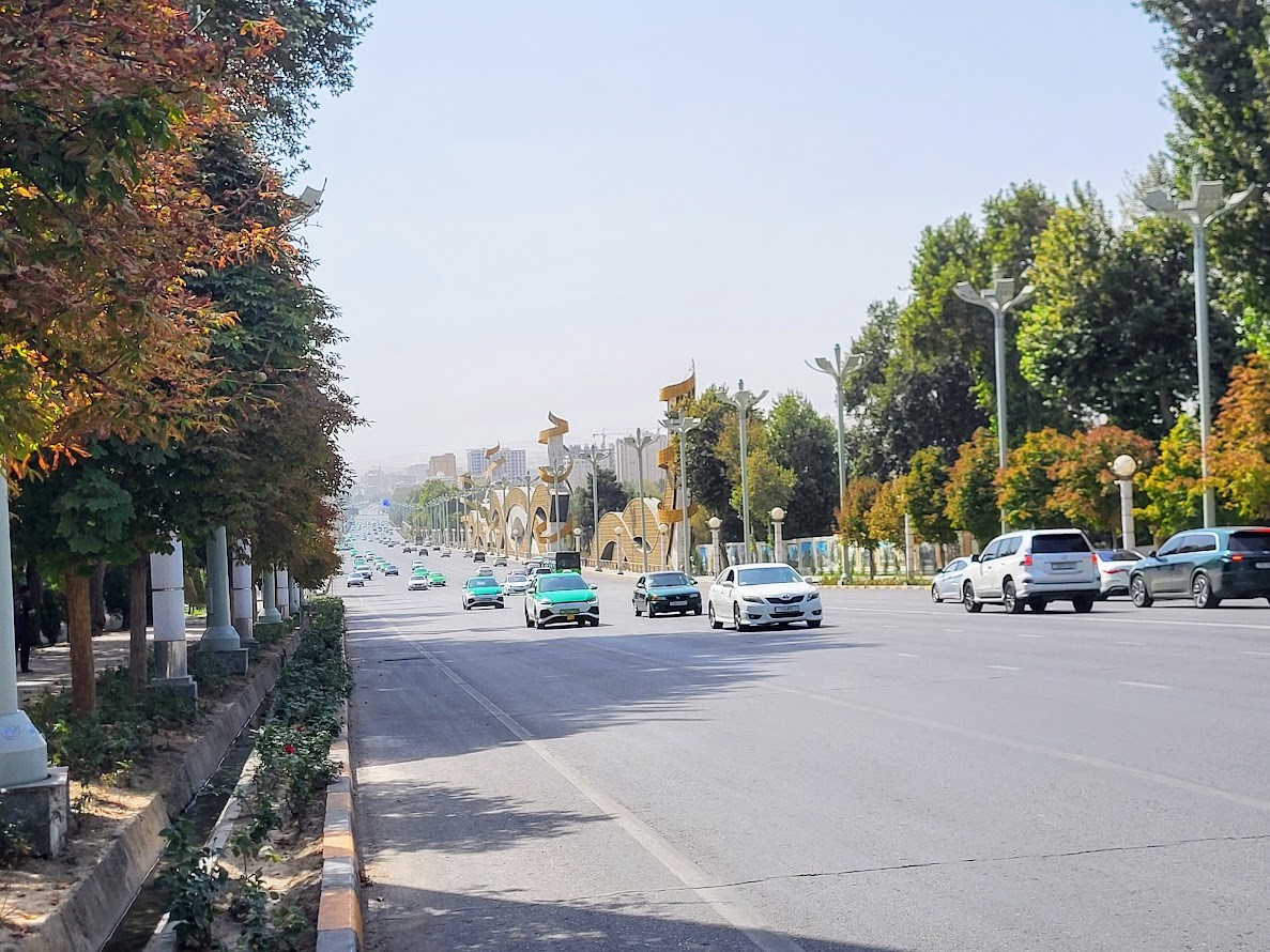
Upon arrival at Dushanbe International Airport, you will be met by our team and transferred into the city. Depending on your arrival time, enjoy a short sightseeing tour of Tajikistan’s capital. Highlights include Rudaki Park, the National Flagpole, and a panoramic city drive showcasing modern Dushanbe.Optional visits include the National Museum, the Museum of Antiquities, or the vibrant Mehrgon Central Market for insight into local culture and daily life.After lunch, depart toward the Pamirs. En route, stop at the impressive Nurek Reservoir—one of the largest artificial lakes in Central Asia—before continuing via Kulob. As the road follows the Panj River, dramatic landscapes unfold, with Afghanistan visible across the river.Arrival in Qalai Khumb in the late afternoon. Overnight at a guesthouse.
- Driving: 360.00 km
- Temps de route: 5-6 hours
- Hiking distance: 0.00 km
- Nuit: Qalai Khumb (Guesthouse/Homestay)
- Altitude: Dushanbe ~800 m | Qalai Khumb ~1,300 m
- État des routes: Asphalt

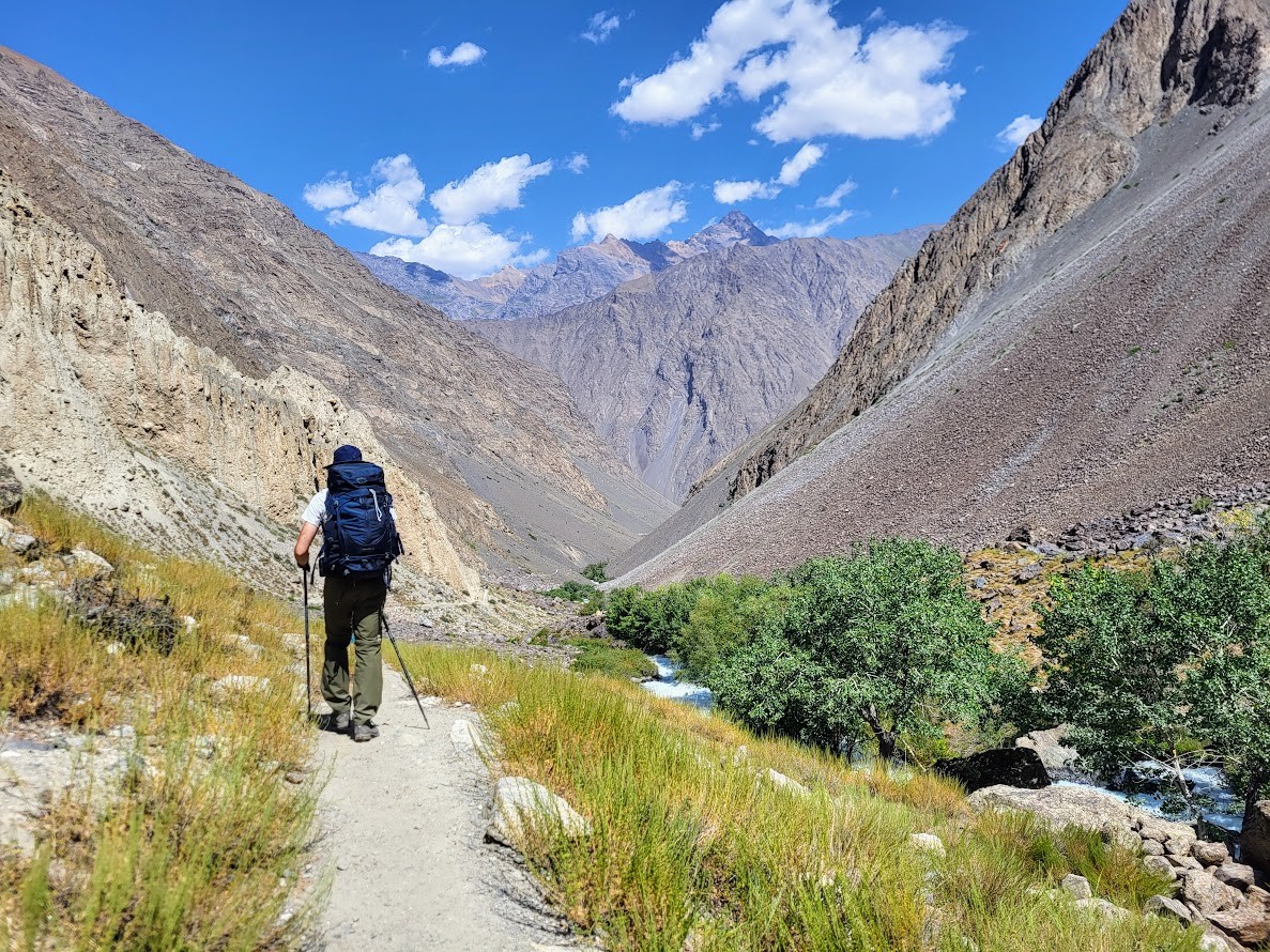
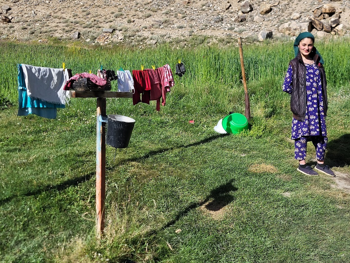
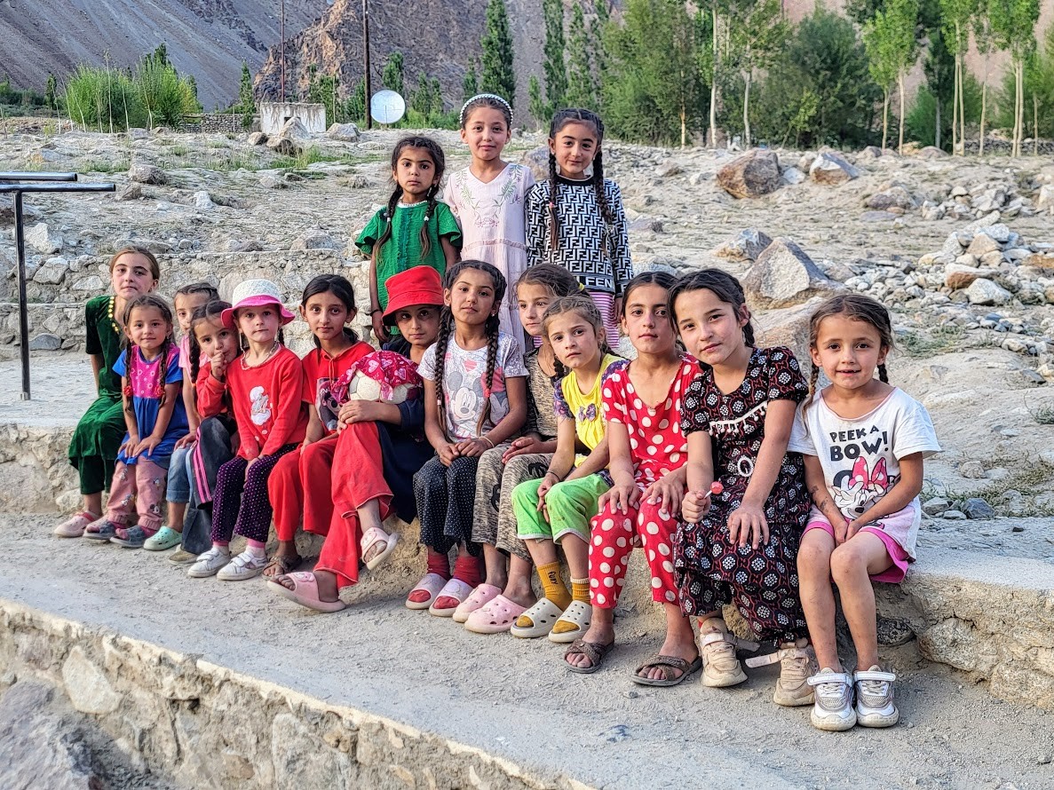
After breakfast, drive into the remote and spectacular Bartang Valley—one of the wildest regions of the Pamirs. Narrow gorges, powerful rivers, and isolated mountain villages dominate the scenery.At the end of the road, begin a scenic hike of approximately 7 km. The trail gradually ascends through alpine terrain, crossing streams and passing small mountain lakes. The climb is steady but not technically difficult.By late afternoon, arrive in Jizew Village, a lush green oasis hidden deep in the mountains. Dinner and overnight in a local homestay, experiencing warm Pamiri hospitality.
- Driving: 250.00 km
- Temps de route: 5 hours
- Hiking distance: 7.00 km
- Nuit: Jizew Village (Homestay)
- Altitude: Start ~2,100 m | Jizew ~2,600 m
- Point le plus haut: 2600
- État des routes: Partly paved, partly rough
In the morning, hike back along the same trail to the main road, where your vehicle awaits. Continue driving to Khorog, the administrative and cultural center of the Gorno-Badakhshan region.In the afternoon, visit the Khorog Botanical Garden—one of the highest-altitude botanical gardens in the world—offering spectacular valley views. Stroll through the central park and local market. Overnight in a hotel or guesthouse.
- Driving: 90.00 km
- Temps de route: 1-2 hours
- Hiking distance: 7.00 km
- Nuit: Khorog (Hotel or Guesthouse)
- Altitude: 2200
- État des routes: Partly paved, partly rough
Early morning drive toward one of the most beautiful valleys in the Pamirs, following one of the five branches of the Panj River. The valley gradually widens, revealing ever-changing landscapes and dramatic scenery.Arrive at Jawshangoz, the last village in the valley. From here, enjoy excellent views of Peak Engels. Overnight in a homestay
- Driving: 230.00 km
- Temps de route: 5-6 hours
- Hiking distance: 0.00 km
- Altitude: 3400
- État des routes: Mixed
After breakfast, drive to the last accessible point, then hike toward the viewpoints of Peaks Karl Marx and Engels. Set up camp if conditions allow, then continue hiking.Today focuses on acclimatization and preparation for upcoming trekking days. Enjoy lunch with breathtaking mountain views before returning to camp. Overnight in tents.
- Driving: 25.00 km
- Temps de route: 1 hours
- Hiking distance: 8.00 km
- Nuit: Tent
- Altitude: 4,100–4,550 m
- Point le plus haut: 4,550 m
- État des routes: mixed
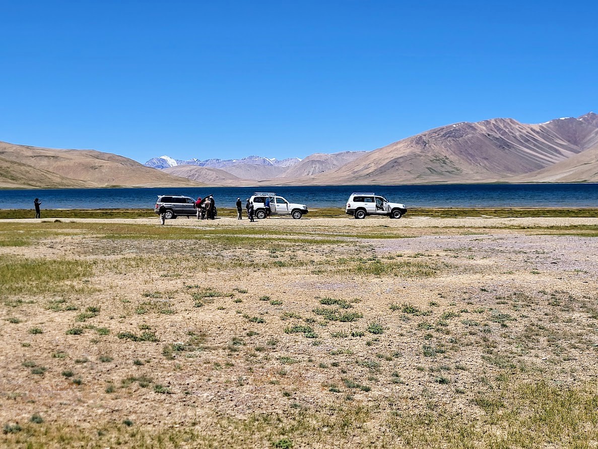
After breakfast, descend slightly and drive over the Maysara Pass (4,450 m). Stop near Turumtaikul Lake for photos and a visit with local herders to observe daily life and dairy production.Rejoin the Pamir Highway, cross Kutezak Pass (4,500 m), and continue to Bulunkul—the coldest village in Tajikistan, where winter temperatures can drop to –60°C. Overnight in a homestay.
- Driving: 250.00 km
- Temps de route: approx. 6 hours
- Hiking distance: 0.00 km
- Nuit: Guesthouse in Bulunkul
- Altitude: approx. 3,700 m (maysara Pass approx. 4,500 m)
- Point le plus haut: 4500
- État des routes: mixed
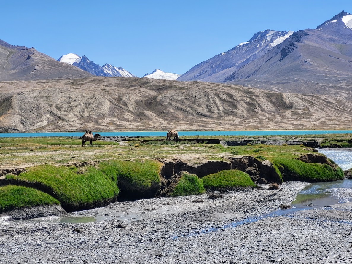
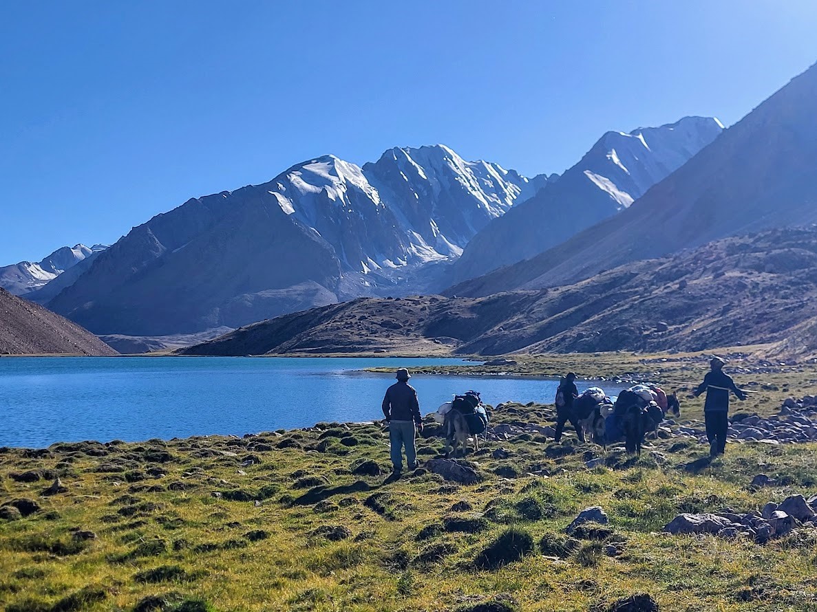
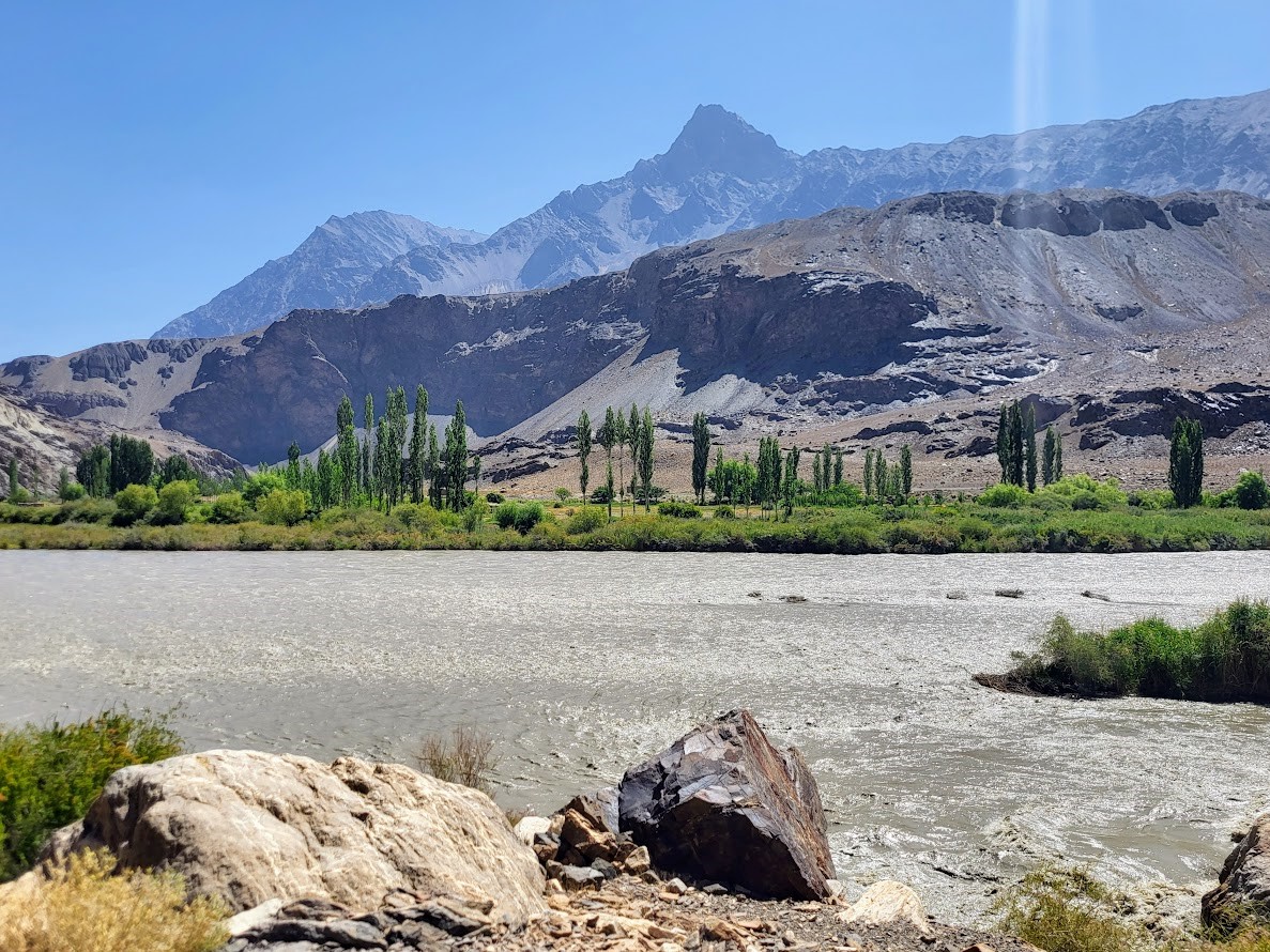
An early start is required today. After crossing the river by small local boat, you meet the donkey team on the opposite bank and transfer your main luggage to pack animals. From this point onward, the journey becomes a true wilderness trek.The route follows the vast shoreline of Yashilkul Lake, one of the largest high-altitude lakes in the Pamirs. The terrain is mostly flat and open, allowing a steady walking rhythm while enjoying expansive views across the water and surrounding plateau. The feeling of isolation is profound, with no permanent settlements in sight.Two shallow river crossings are encountered en route. In the late afternoon, the campsite is established near the lake, offering stunning reflections of the surrounding mountains at sunset. Overnight in tents.
- Driving: 0.00 km
- Temps de route: 8 hours of trekking
- Hiking distance: 18.00 km
- Nuit: Tent
- Altitude: 3850
- État des routes: rocky and sandy
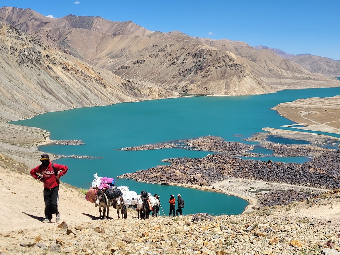
The day begins with a river crossing before continuing along the lakeshore for several hours. Gradually, the route turns inland and ascends toward Bugromoy Pass (4,350 m). The climb is steady and demanding due to altitude, but technically straightforward.From the pass, panoramic views open toward the Bartang Valley, revealing a dramatic shift in landscape—from wide alpine plateau to rugged mountain terrain. The descent follows sandy and rocky trails, requiring careful footing. Natural water sources are available along the route.Camp is established in a remote alpine location, surrounded by high peaks and silence.
- Driving: 0.00 km
- Temps de route: 8 hours of trekking
- Hiking distance: 18.00 km
- Nuit: tent
- Altitude: 4100
- Point le plus haut: 4100
- État des routes: mixed
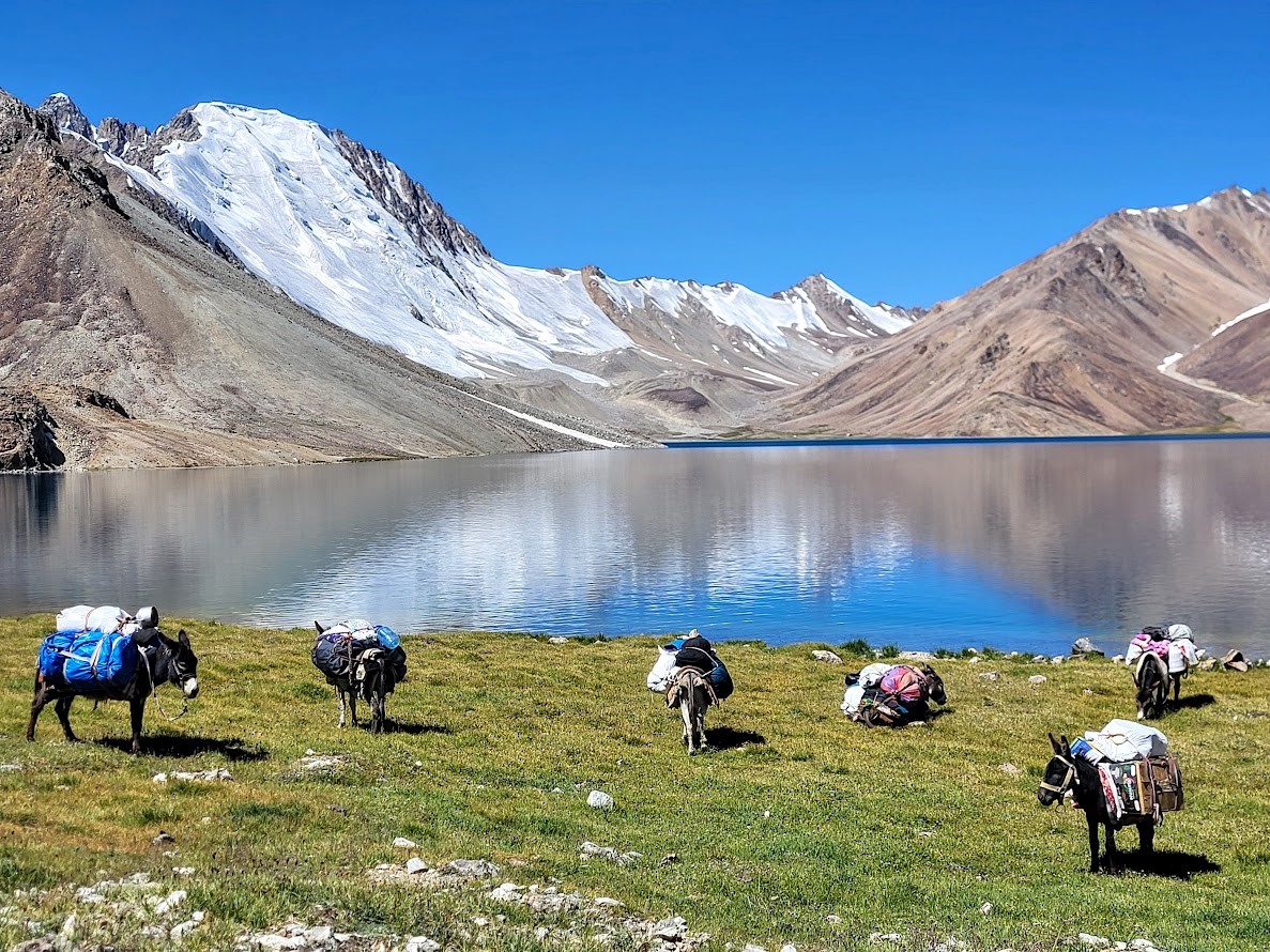
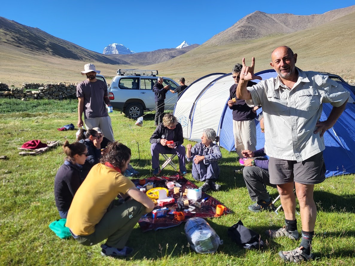
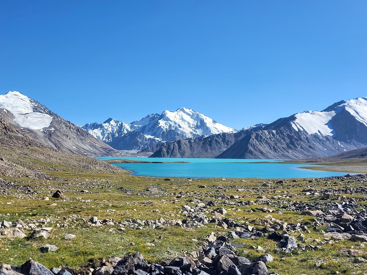
Today’s trek leads through one of the most visually striking sections of the expedition. While the pack animals follow an alternative route, the group ascends toward Chapdar Lake, situated at analtitude of approximately 4,550 m.The lake’s deep blue waters, framed by rocky slopes and snow-covered ridges, create an unforgettable high-mountain landscape. Time is allowed for rest and lunch beside the lake before descending into a broad alpine basin.By late afternoon, reunite with the donkey team and establish camp. Evening temperatures are noticeably colder at this elevation. Overnight in tents.
- Driving: 0.00 km
- Temps de route: 8 hours of trekking
- Hiking distance: 18.00 km
- Nuit: tent
- Altitude: 4000
- État des routes: mixed
A comparatively short and relaxed trekking day, allowing the body to recover after consecutive long stages. The trail follows gentle terrain through open valleys and seasonal grazing areas.En route, stop at a herder’s stone shelter for tea, offering insight into the nomadic lifestyle still practiced in this remote region. Pass the Uch Lakes—three small, clear alpine lakes set against a wide mountain backdrop.Arrive at camp by midday, leaving time for rest, washing, and exploration of the surrounding area. Overnight in tents
- Driving: 0.00 km
- Temps de route: 5 hours of trekking
- Hiking distance: 12.00 km
- Nuit: tent
- Altitude: 3900
- État des routes: mixed
Although shorter in distance, today’s stage is physically demanding due to a continuous ascent of approximately 500 meters. The pace is intentionally slow, with frequent rest stops to support acclimatization.The trail passes a series of pristine high-altitude lakes, each with its own distinct character, and gradually approaches glaciated terrain. Snowfields and ice formations become visible near Zarosh Lake.Camp is set below the lake in a wind-exposed area. This is typically the coldest night of the expedition, and an early dinner is recommended in preparation for the
- Driving: 0.00 km
- Temps de route: 5 hours of trekking
- Hiking distance: 16.00 km
- Nuit: tent
- Altitude: 4350m
- Point le plus haut: 4350
- État des routes: rocky
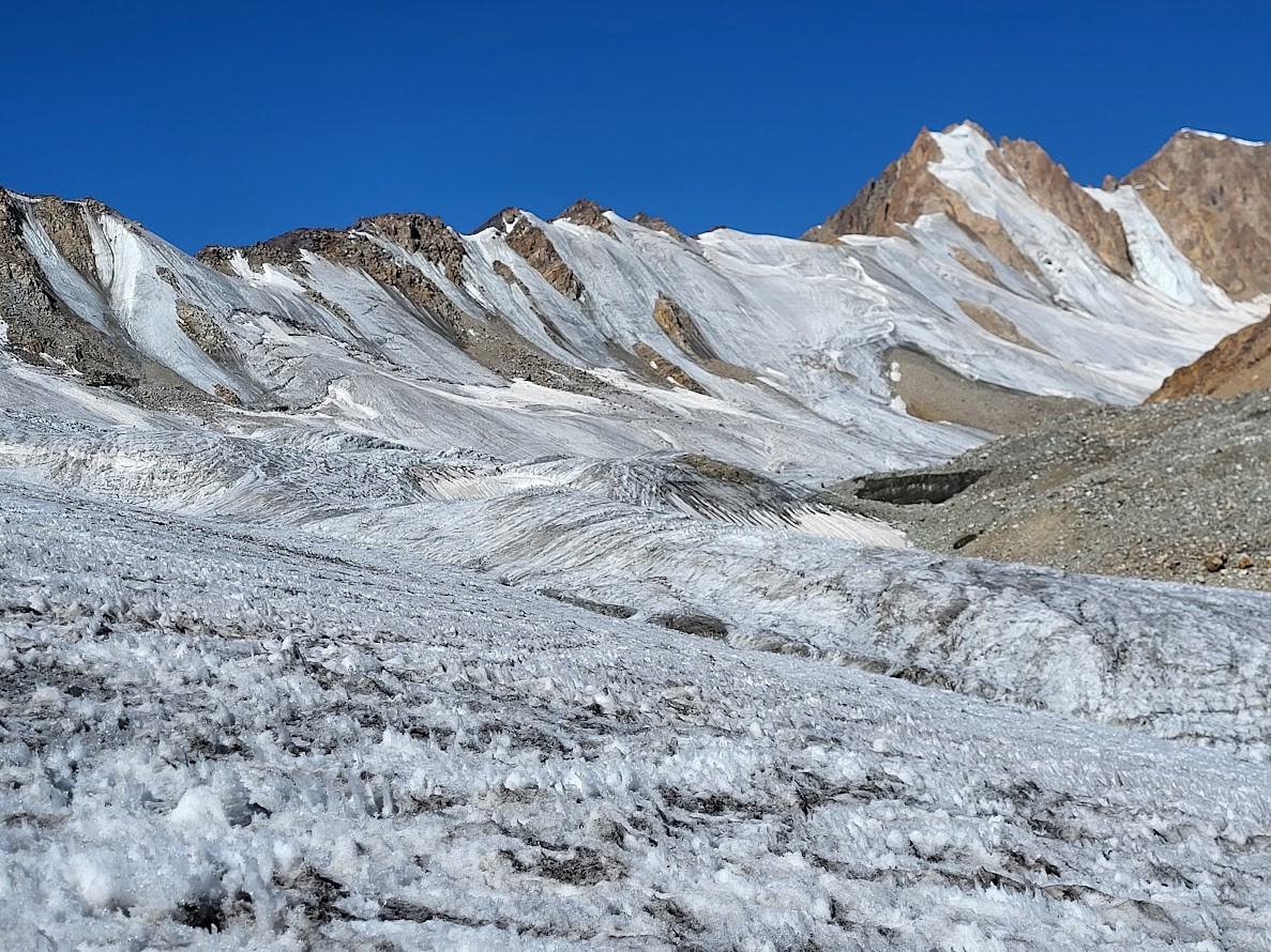
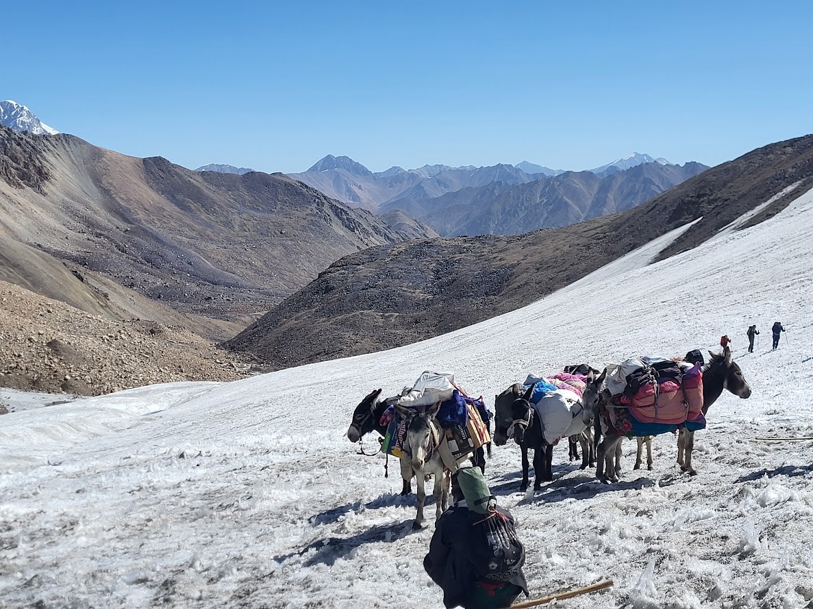
Departure is early to ensure safe glacier conditions. The glacier crossing, approximately one hour in duration, is conducted carefully under the guidance of experienced staff. Occasional rockfall is possible, and attention is required.After crossing the highest point of the trek (approximately 4,750 m), there is a strong sense of achievement as the route transitions into a long descent. The landscape changes rapidly, with steep slopes giving way to wide valleys.Following lunch, a final river crossing is assisted by guides and donkey handlers. Camp is established in a sheltered location. Overnight in tents
- Driving: 0.00 km
- Temps de route: 7-8 hours of trekking
- Hiking distance: 18.00 km
- Nuit: tent
- Altitude: 3700
- Point le plus haut: 4850m
- État des routes: sandy and rockky
The final trekking day follows the river downstream toward Bardara Village. The trail is well-defined and relatively easy, allowing time to reflect on the journey.Arrival in the village is expected in the early afternoon. After settling into the homestay, guests are free to explore the village or join the guide to observe local pastoral activities, including traditional milking practices.Dinner and overnight in a homestay, marking the conclusion of the trekking portion of the expedition
- Driving: 0.00 km
- Temps de route: 7-8 hours of trekking
- Hiking distance: 14.00 km
- Nuit: homestay
- Altitude: 2800
- Point le plus haut: 3500
- État des routes: mixed
After breakfast, bid farewell to the donkey team and local trekking staff who have supported the expedition through the remote highlands of the Pamirs. Rejoin the vehicle and begin the return drive through the dramatic Bartang Valley, following the river downstream toward the Panj River.The journey offers a final opportunity to observe traditional village life in one of Tajikistan’s most isolated regions. Several stops can be made along the way to visit small settlements, photograph terraced fields, and interact with local residents. The landscape gradually changes as the valley widens and vegetation becomes more abundant.Lunch is taken in Rushan, the administrative center of the district, before continuing along the Panj River—once again marking the natural border between Tajikistan and Afghanistan. Arrival in Qalai Khumb is expected in the late afternoon.Dinner and overnight at a guesthouse, with time to rest after the expedition’s conclusion.
- Driving: 360.00 km
- Temps de route: 5-6 hours
- Hiking distance: 0.00 km
- Nuit: guest house
- Altitude: 1300
- État des routes: asphalt
Following breakfast, depart Qalai Khumb and drive back to Dushanbe. The route retraces the Panj River corridor before gradually ascending toward central Tajikistan.Several scenic and comfort stops are made along the way, allowing time for photographs and short breaks. As the altitude decreases, the scenery transitions from rugged mountain terrain to rolling hills and fertile valleys.Arrival in Dushanbe is scheduled for the late afternoon. Upon arrival, transfer to your hotel or onward arrangements as required. This marks the official end of the Pamir & Bartang Valley Expedition
- Driving: 350.00 km
- Temps de route: 5-6 hours
- Hiking distance: 0.00 km
- Nuit: Hotel (if required
- Altitude: 850
- État des routes: Asphalt
Included
- Inclusions
- Meals as specified in the travel description (full board during the trip and trekking )
- Drinks (water, tea, coffee) and snacks during the tour (dried fruits, nuts, chocolate bars, fruit) during the trekking
- Luggage transport and accompanying vehicle that can be switched to if needed
- Donkey and perter during the trek
- Cock and assistance of guide during the trekking
- Airport transfers on the arrival and departure day of the group trip
- local accompanying staff during the tour (guide, driver)
- English speaking guide experienced
Non inclus
- GBAO permit and visa if they need
- Entrance fees to sights as per itinerary and national park entrance
Départs
| Départs | Statut | Réservation |
|---|---|---|
|
Jun 10 - Jun 24, 0006
trekking 1
|
Réservé: 0 Disponible: —
|
From
USD 1,850
USD 1,850
(7% OFF)
|
|
Jul 01 - Jul 15, 2026
trekking
|
Réservé: 0 Disponible: —
|
From
USD 1,850
|
|
Jul 20 - Aug 04, 2026
trekking 3
|
Réservé: 0 Disponible: —
|
From
USD 1,850
|
|
Aug 15 - Aug 29, 2026
trekking 4
|
Réservé: 0 Disponible: —
|
From
USD 1,850
|
Pamir & Bartang Trek – 15 Days
Your journey begins with your first step.”
à partir de USD 1,850
- Durée: 15 jours / 14 nights
- Route: Dushanbe → Dushanbe
- Pays: Tajikistan-Tajikistan